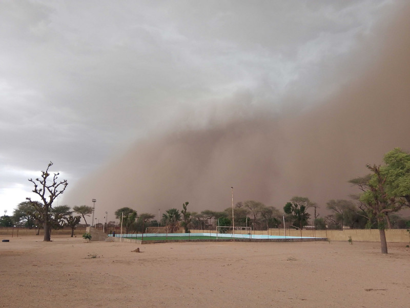
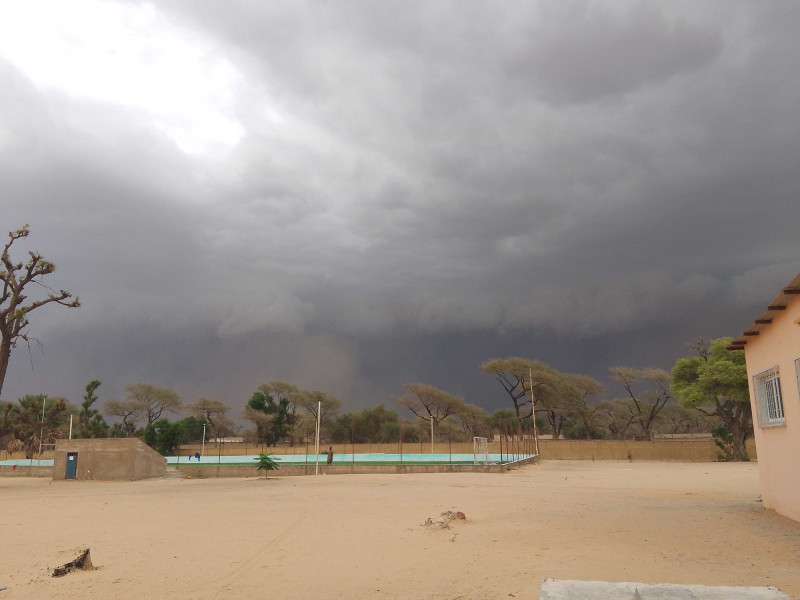
 is a dust storm created by the cold pool which spreads ahead of the thunderstorm and lifts the dust up in the air. | Photo: Maxime Colin, ZMT")
17/11/2025 | Scientists from the University of Potsdam, the University Cheikh Anta Diop (UCAD), Dakar, and ZMT joined efforts again in June-July 2025 and September 2025 to expand the existing DakE weather station network in Senegal. DakE is a field campaign on “High resolution weather observations east of Dakar” which has been active since Spring 2023. It was initiated at ZMT and has been funded by the European Research Council (ERC) since July 2024 through the University of Potsdam.
Senegal is particularly vulnerable to flooding resulting from: heavy rainfalls that occur during the monsoon season, insufficient drainage systems in metropolitan areas and rapidly growing urban populations.
“The Sahel is a critical climate zone, at the interface between the wet tropical Gulf of Guinea and the dry Sahara desert, and monitoring its long-term change, directly on the ground, is particularly meaningful", says Jan Härter, who leads the DakE project. He adds: “And the role that the soil moisture can play in modulating future rainfall is unique in this region of the world.".
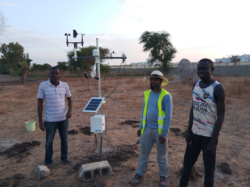
During their field work, the team installed five additional weather stations in local schools in Sandiara, Joal-Fadiout, Keur Martin, Ndoung and Ndiaganiao – the latter is the home village of the current Senegalese President, Bassirou Diomaye Faye.
The network of weather stations now covers a larger region towards the South-East of Dakar, where more rainfall usually occurs. This will give rise to a larger rainfall dataset to study the properties of thunderstorm cloud systems in this region.
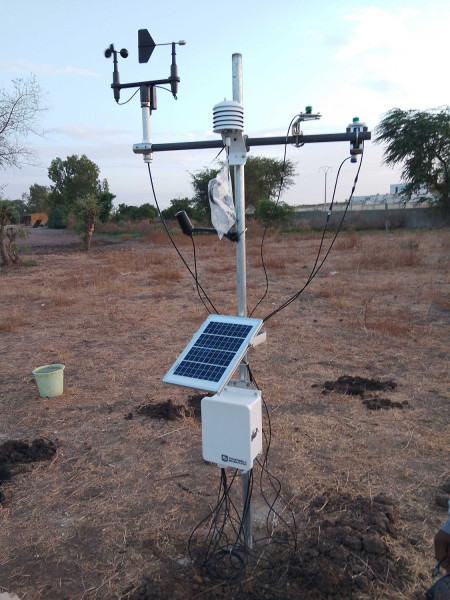
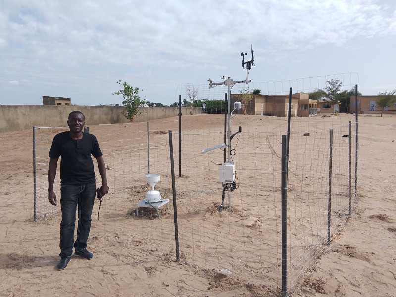
The existing network of twelve automatic weather stations has now been extended by five high-quality Campbell stations to supplement the previous set-up. Aside from recording atmospheric variables (air temperature, humidity, pressure, wind direction, wind speed, precipitation) at high temporal resolution they also measure radiation variables such as solar radiation reaching the Earth’s surface and infrared radiation received from the atmosphere or the surface). In addition, they also monitor soil variables such as soil temperature and moisture at different depths of 10, 20, 40 and 60 cm.
“Technically, there is a strong need for measurement data which is something that our Senegalese colleagues always highlight,” says DakE coordinator Mai-Britt Berghöfer from University of Potsdam. “And scientifically, the region is a fascinating place to study with mesoscale convective systems that produce precipitation structures that follow a more simple geometry than in other parts of the world.”
From Satellite Maps to Concrete Foundations
Setting up a weather station on the ground requires preparation, finding a suitable spot as well as knowledge about IT and electronics. Before going to the field, the scientists in Germany pre-connect all the sensors, prepare the software that will be used to handle the data automatically, and test the connectivity.
Using satellite maps the researchers then identify potential sites. “Ideally, we need an open field without obstructions by buildings or vegetation, so that the wind and other atmospheric measurements can be made according to official World Meteorological Organization guidelines,” explains Maxime Colin, an external collaborator in the project from ZMT’s Program Area 2 “Global Change”, and the coordinator of the June-July field work. “We then need to obtain approval to install the weather stations on these suitable sites”.
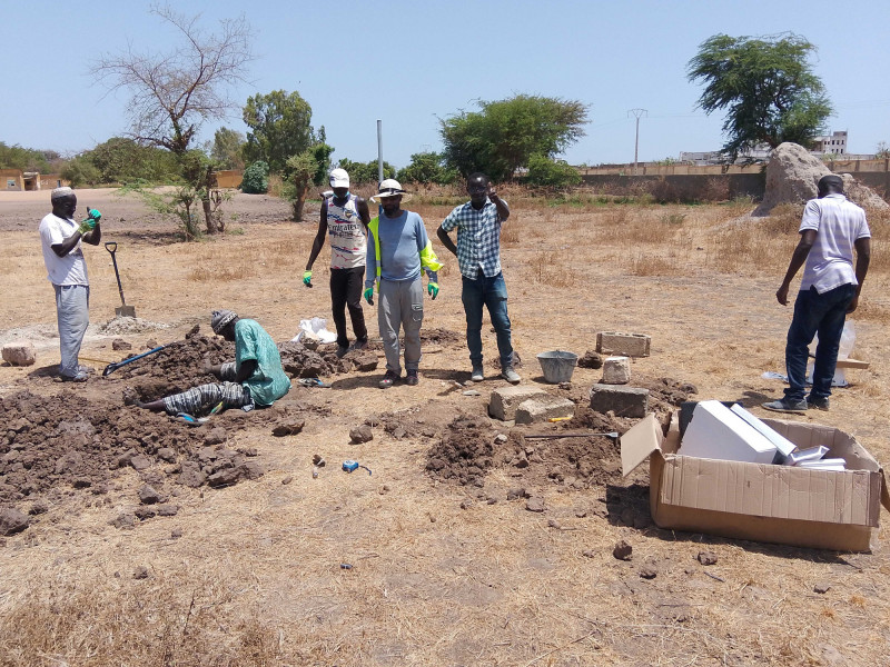
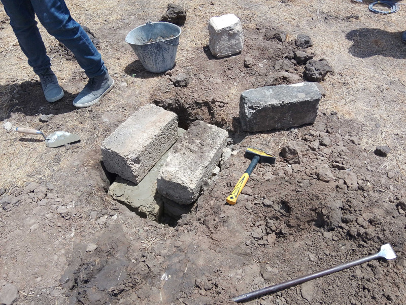
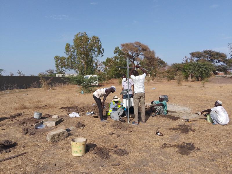
Once permission is granted the digging starts. “We dig holes in the ground for the main pole on which the weather station is set up. Another hole is dug for the rain gauge and then we need to go even deeper to install the soil sensors at 10, 20, 40 and 60 cm depth,” says Dame Gueye from the University Cheikh Anta Diop.
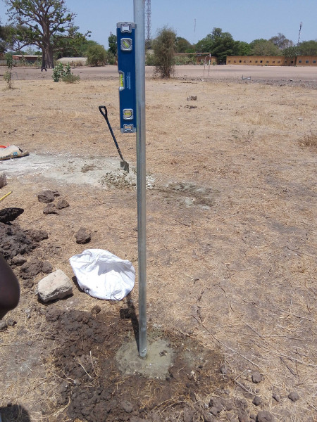
Finally, the teams set up another 12 poles for the fence to protect the station. All holes will then be filled with concrete to anchor the poles firmly in the ground.
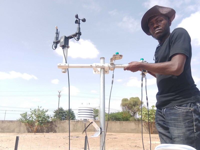
“Only now can we start to set up all the sensors one by one at their location on the pole,” says Yahaya Bashiru from University of Potsdam and ZMT. “ We then have to correctly connect all 50 electric cables in the data logger which collects the information and sends it with a SIM card to the internet. Setting up the software to correctly submit the data was also not an easy task” adds Diana Monroy, from the University of Potsdam.
“After getting permission, setting up a weather station like this can take two days with up to eight people working hard under the sun,” adds Didier Gati-Mounga from UCAD.
When the dust rises: Weather phenomenon “Haboob”
During this trip, the scientists were able to observe an intense dust storm, termed “haboob” – dust lifted by turbulent wind which progresses quickly just before the thunderstorm cluster arrives.
“A haboob is an effect of cold pools propagating on dry, dusty soil, and it is one of the main phenomena that we plan to study with the DakE data,” explains Maxime Colin. “Cold pools are cold volumes of air near the ground which are generated by rain evaporation during thunderstorms. They are a key element to understand how a storm moves in space and time. For me this was the first cold pool I witnessed in Africa which was very special.”
“We now have to think about keeping the network up and running over the long term”, says Jan Härter. “So we are now looking for new sources of funding to be able to carry out necessary maintenance, replacing parts, and keeping our Senegalese colleagues engaged with the project.”


And the digging starts to set up the weather station in Sandiara (with, from left to right, two local helpers from Sandiara, Dame Gueye, Yahaya Bashiru, Dioumacor Faye, Didier Gati-Mounga) | Photo: Maxime Colin, ZMT


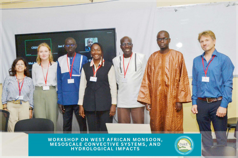
International workshop at UCAD
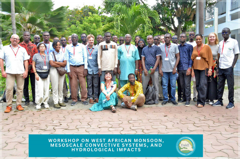
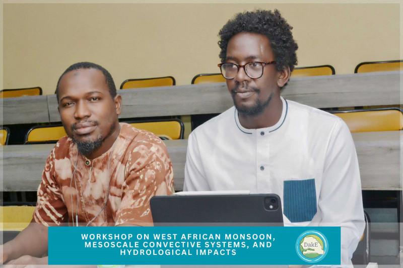
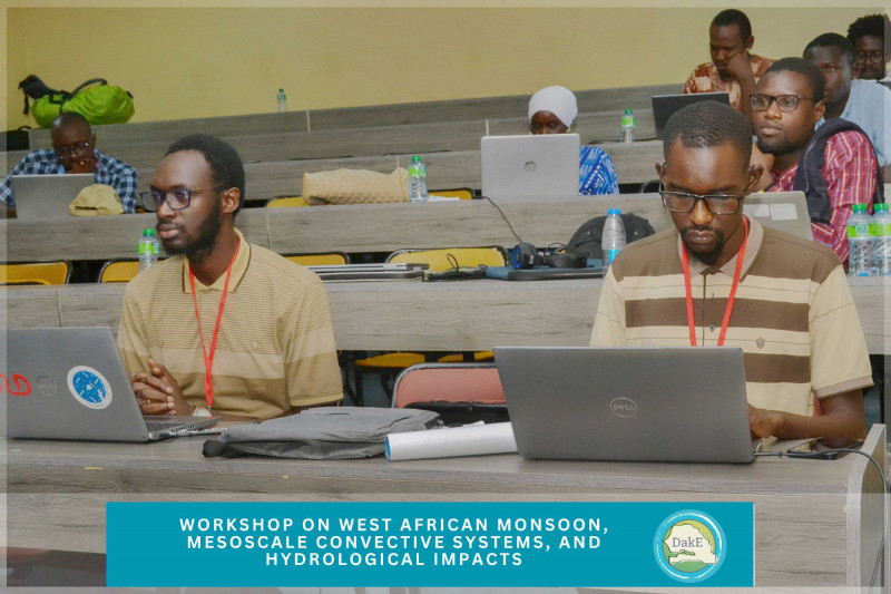
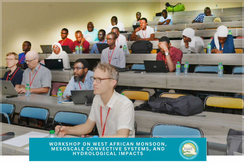
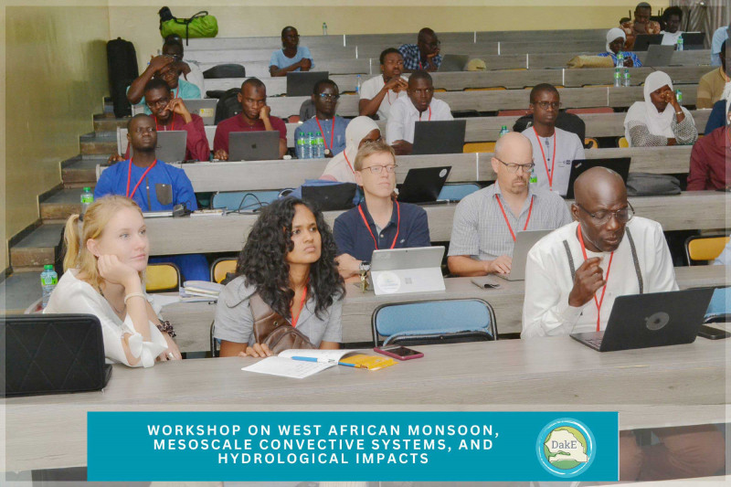
The Expansion of weather stations in July was complemented by an international workshop “West African monsoon, mesoscale convective systems and hydrological impacts“ with scientists and stakeholders, which was held at UCAD, Dakar, during the period of Sept 10 - 14, 2025. It brought together approximately 50 scientists and stakeholders from a range of African countries and beyond. This workshop may help foster future academic exchange between sub-Saharan Africa and Germany.
This workshop was organized by the DakE team and involved scientific talks and a day of outreach activities, which allowed students and teachers from many of the schools involved in the DakE project to learn more about the scientific goals of the project. The latter outreach activity was held at École Nationale Supérieure d'Agriculture (ENSA), Thiès, one of the collaborating institutes within DakE. During this outreach event, we talked to school children and their teachers about the weather station they have in their schools, about climate change and climate science in general.
It was organised under the leadership of Prof. Jan Härter (University of Potsdam) and Prof. Amadou Gaye (UCAD), and thanks to the effort by Mai-Britt Berghöfer (University of Potsdam), Diana Monroy (University of Potsdam) and Dame Gueye (UCAD).


International workshop “West African monsoon, mesoscale convective systems and hydrological impacts“ with scientists and stakeholders, which was held at UCAD, Dakar, during the period of Sept 10 - 14, 2025 | Photo: DakE project, University of Potsdam


About the DakE project:
The DakE-Project at the University of Potsdam aims to build a high-resolution observational network east of Dakar to observe mesoscale convective systems at near real time. The collected data is expected to help improve the understanding of the formation and decay of mesoscale convective systems and to assess the risk of extreme thunderstorm events. The project is funded by the European Research Council’s (ERC) Proof of Concept programme.